
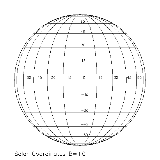
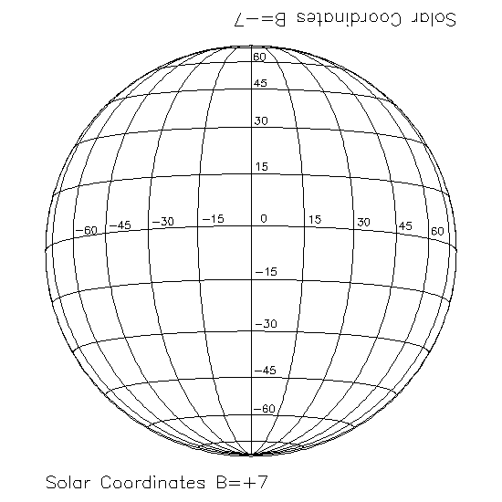
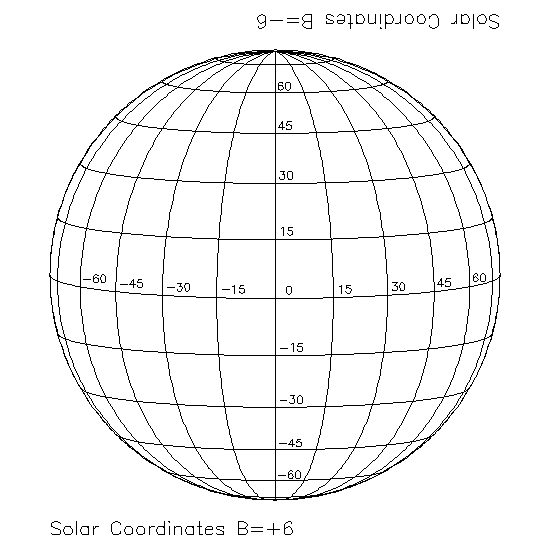
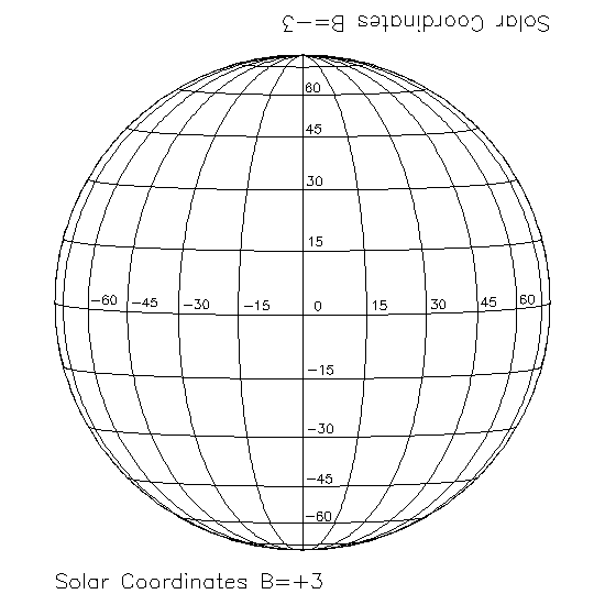
The Earth doesn't orbit exactly around the Sun's equator, so through the year the center of the solar pictures moves up and down a little more than 7 degrees. This angle varies sinusoidally through the year and is called B0. Earth crosses the Sun's equator about December 7 and June 7 each year.
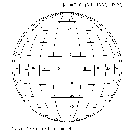
Sunspots and other features will rotate across the visible image along lines of latitude (unless they drift!). To help you determine the latitude and longitude for each image we've drawn circles with lines of latitude and longitude every 15 degrees for several values of B0. These are called Stoneyhurst disks.
You can use the one for zero inclination (the one above) if you like; it's not too bad. But if you would like to be a little more precise, use the map that is appropriate for the time your observations were taken. For months that list 'negative B0,' just turn the picture upside down to put the corresponding label on top.